

You're now following
Error following user.
This user does not allow users to follow them.
You are already following this user.
Your membership plan only allows 0 follows. Upgrade here.
Successfully unfollowed
Error unfollowing user.
You have successfully recommended
Error recommending user.
Something went wrong. Please refresh the page and try again.
Email successfully verified.

sofia, bulgaria
It's currently 9:09 PM here
Joined May 23, 2014
0 Recommendations
Anelia A.
@nelalexieva
0.0
0.0
0%
0%
sofia, bulgaria
N/A
Jobs Completed
N/A
On Budget
N/A
On Time
N/A
Repeat Hire Rate
Expert GIS, KMZ/KLM files and Google Earth, Google map, Open street map, data base and research
Contact Anelia A. about your job
Log in to discuss any details over chat.
Portfolio
Portfolio
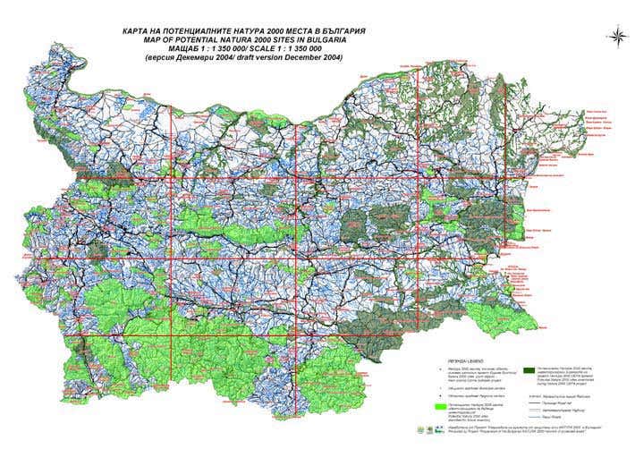

Map of protected areas
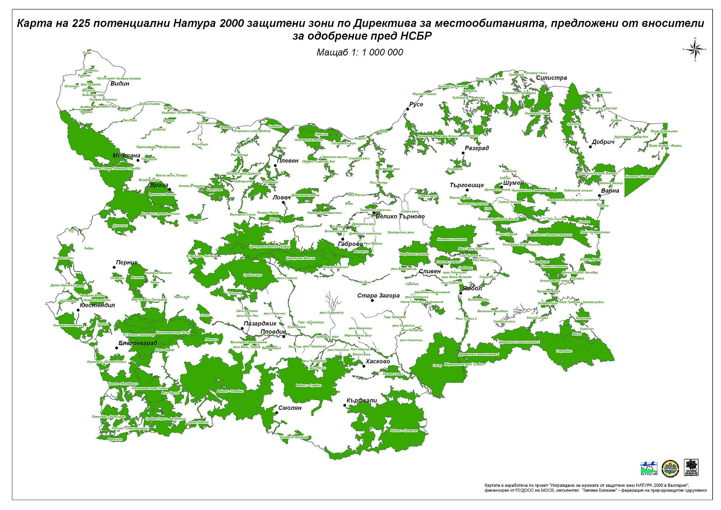

Habitats
Map of protected areas
Habitats
Reviews
Changes saved
No reviews to see here!
Experience
Expert GIS and database
May 2009 - Jan 2015 (5 years, 8 months)
Expert GIS and database
May 2004 - May 2009 (5 years)
Project: “Development of European network of protected areas NATURA 2000 in Bulgaria”, GIS of protected areas, generalizing of the database, responding to the project tasks. Thematic maps, templates and plotting of maps for EU. Visualization of object measured in the field with GPS, preparation of maps for terrain investigations. Generalization of boundaries connected with habitats of flora and fauna species. Boundaries are generalized according to cadastral property, land cover, forest information, terrain investigations of habitats. Preparing of maps for Black sea habitats atlas, exporting images for a movie Natura 2000.
Expert GIS and database
May 2002 - May 2003 (1 year)
Project: “Data processing of existing, basic for management information for all 33 existing and potential Ramsar objects in Bulgaria by creating of GIS and data base” – a company BSBP, RAMSAR Division protection de la nature SWITZERLAND., GIS and database, thematic maps and templates.
Education
high
(5 years)
Contact Anelia A. about your job
Log in to discuss any details over chat.
Verifications
Top Skills
Browse Similar Freelancers
Browse Similar Showcases
Invite sent successfully!
Thanks! We’ve emailed you a link to claim your free credit.
Something went wrong while sending your email. Please try again.
Copy to clipboard failed, please try again after adjusting your permissions.
Copied to clipboard.
Loading preview
Permission granted for Geolocation.
Your login session has expired and you have been logged out. Please log in again.